

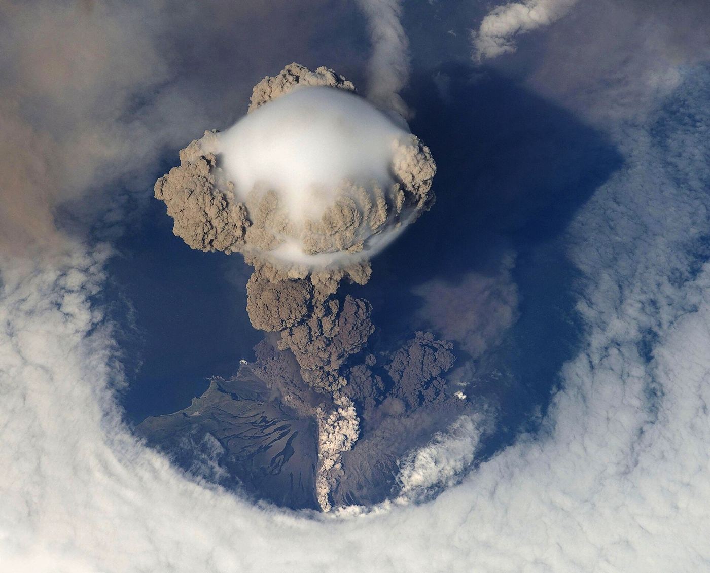
Volcanic ash is far more than a dramatic sky spectacle. Its fine, abrasive particles can damage aircraft engines, close airports hundreds of kilometres away and settle over towns, contaminating water supplies and making breathing difficult for vulnerable people. Forecasting where an ash plume will travel has long been uncertain, because eruptions change intensity quickly and winds vary sharply with altitude. Volcano observatories are now combining ground sensors, satellite measurements and weather models updated hour by hour to produce far more precise plume forecasts than the broad warnings of the past. Cameras and gas sensors on the volcano itself estimate how much ash is being released and how high it is rising, while satellites track the plume’s actual movement so models can be corrected against reality rather than drifting. Aviation authorities, which must decide whether air routes can operate safely, say the improved detail allows narrower closures, keeping more flights running while still steering aircraft well clear of hazardous airspace. Airlines say clearer forecasts also reduce fuel waste from unnecessarily long diversions around suspected ash.
What the Evidence Shows
The benefits extend well beyond aviation. Farmers receiving accurate ashfall forecasts can move livestock, cover feed stores and protect machinery, while water companies can prepare filtration systems before ash reaches reservoirs. Public health teams use the same forecasts to advise residents on masks and staying indoors on the heaviest days. Building the system requires international cooperation, because plumes cross borders quickly and satellites operated by different agencies must be stitched into a single picture. Researchers are also training models on records of past eruptions so that early signals, such as a sudden change in gas composition or plume height, can be translated into likely scenarios faster. No forecast will ever make an eruption safe or fully predictable, and observatories are careful to communicate uncertainty honestly. But the shift from occasional bulletins to continuously updated, sensor-driven guidance represents a real change in how societies live alongside active volcanoes, replacing guesswork with evidence during the most anxious hours. Reporting and analysis from sources such as NASA track the same developments, and specialists following the hourly volcano ash forecast say the direction is now consistent across independent lines of evidence.
The Wider Context
Funding bodies are watching the hourly volcano ash forecast closely because the work sits at the junction of basic curiosity and practical return. Grant panels increasingly ask for a path from discovery to application, while researchers push back that the most valuable uses of fundamental science are rarely the ones written into the original proposal. The tension is productive when both sides stay honest about timescales.
What Happens Next
The long view on the hourly volcano ash forecast is that fields advance by accumulation rather than by single announcements. This result adds a solid, checkable piece to a structure many teams are building, and its authors have shared their data so the piece can be tested from every side. That is how the picture eventually becomes reliable enough to act on. You can follow related developments in our coverage of science.
It is also worth remembering how quickly the picture in this area has changed before. Positions that looked settled a few years ago have been revised as new data arrived, and the same humility is appropriate now. The strongest coverage of this subject, and the most useful advice, tends to come from sources that update their views openly when the facts move, rather than defending an earlier position long after it has stopped fitting the evidence available.
